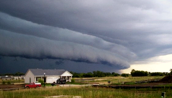
Say it together now “deh-REY-cho”. So what is this phenomenon that tends to strike the Upper Mississippi Valley through the Ohio Valley during the summer months? It is a widespread, long-lived wind storm that typically produces damage in one direction along a relatively straight path. Technically speaking, if a swath of wind damage covers over 250 miles, has wind gusts of 58 mph or more and multiple gusts of 75 mph or greater it may be classified as a derecho. Derechos are associated with bands of showers or thunderstorms that have a curved or bowed shape- hence the name bow echoes. In addition, these little nasties can spawn tornadoes and create flash flooding- hmmmmm, how delightful 🙁

Bow Echo in Illinois, 2008. Eerily beautiful- Credit- http://www.spc.noaa.gov/misc/AbtDerechos/derechofacts.htm
Not so Fun Fact- Some of the most extreme derechos have come on tail end of major heat waves. Talk about adding insult to injury!
Preliminary reports from the derecho that tore through the Midwest last night included; four tornadoes that touched down in Illinois, localized flooding in several low lying areas, and over 130 high wind reports across Ohio, Indiana, North Carolina and Kentucky. Unfortunately, the severe weather is forecast to continue today. Scattered severe thunderstorms capable of producing damaging straight line winds and hail are expected for a wide swath from the High Plains of the Rockies to the central Appalachians and mid-Atlantic states.

